The weather gods are being extra kind to us this year, providing a usually dry period during the climatologically wettest time of the year.
To illustrate, here is the climatological probability of receiving a hundredth of an inch or more in Seattle over the year. The climatological probability of rain each day is over 60% from November 7 through mid-December. This is typically the wettest time of the year!
The forecast for this week? Absolutely dry with plenty of sun. Take a look at the forecast precipitation total through Saturday at 4 PM. No rain over the Northwest and California.
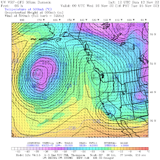
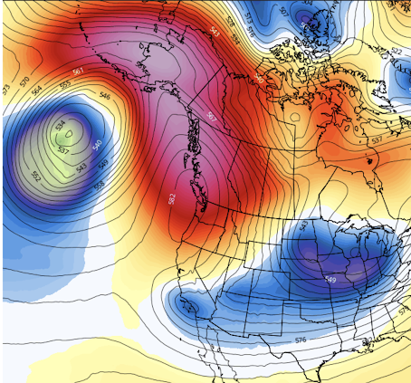
The reason for these dry conditions? The big West Coast ridge is back, as shown by an upper-level map (500 hPa, about 18,000 ft) on Tuesday around 4 PM. The solid lines are heights, but you can think of them as the pressure at around 18,000 ft.
.gif)


Wind tower blades were motionless today NW of Ellensburg. The BPA 5-minute chart- likewise.
ReplyDeleteTime to revisit the European model forecast (10/27 blog post)? November was tracking below normal even before this now entirely dry week up ahead. We've had so little rain for so long, hoping that this is the last dry stretch for a long time!
ReplyDeleteHave you already forgot the many inches of rain we got just a week and a half ago?
DeleteThe air quality around Seattle has unfortunately been sub par the past 3-4 days thanks to what I've heard are fires burning down by Mt. Rainier.
ReplyDeleteEverything I've seen suggests that there have been similar periods - weather patterns - in the 1940's and 1980's. How do those relate to Nino's and Nina's? I'm not sure when those ocean current patterns (cycles) were named and recognized - wouldn't mind learning more about that topic. For the moment, I'm still enjoying the break from constant wet-wet-wet. (Note that I've often observed "early cold" starts becoming "warm-wet winters," for the balance of the season (Jan-April).)
ReplyDeleteYou had like the last 4-5 months of record breaking dry. I think it’s time we get back to “wet-wet-wet”
DeleteIt wouldn't be Thanksgiving week without sloppy weather😂 The only item missing is the regulation windstorm to usher in the 1/2 cooked turkey...
ReplyDeleteBlame it on La Nina. BTW, Is it true what I suspect: That La Nina and El Nino are happening closer together than in the late 20th century, with less time in between for La Nada (i.e., "normal") conditions?
ReplyDelete