My podcast today deals with cold and snow.
And it will give you a foundation regarding the mountain gaps that channel cold air in our region.
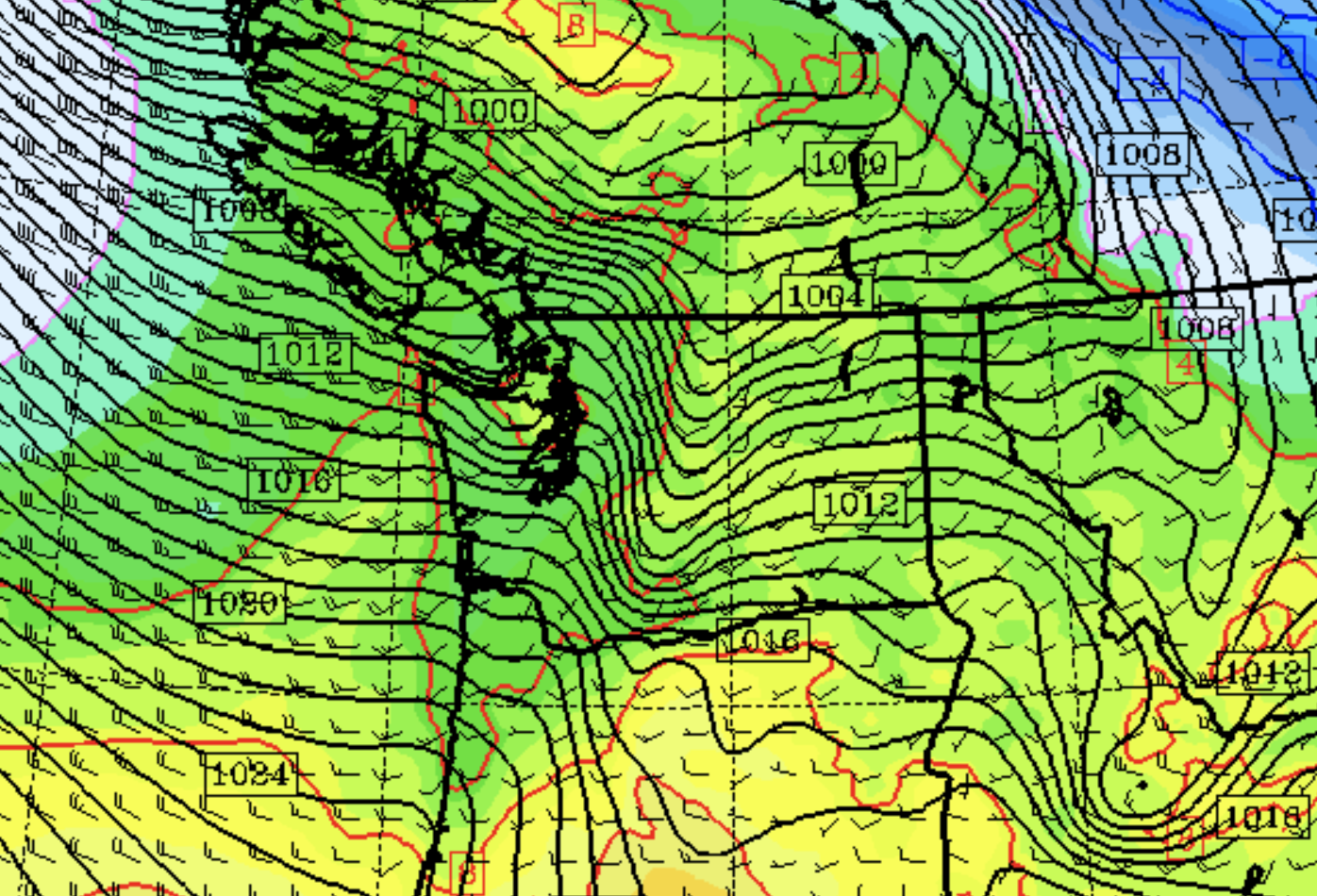
Tomorrow, an approaching front and associated trough of low pressure will rev up the north-south pressure differences, causing strong southerly winds over Puget Sound (see the pressures at mid-day tomorrow below). Gusts to 40 mph can be expected.
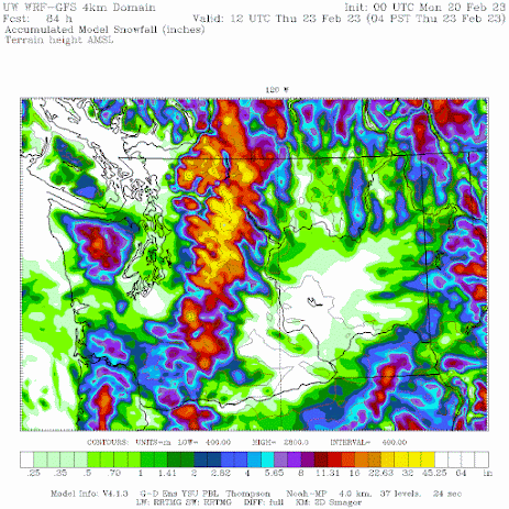
Then a cold front will move through Tuesday morning, bringing lots of snow in the mountains on Tuesday.
Late Tuesday and Wednesday, much colder air will push into Washington state, bringing highs in the 30s and lows in the 20s for western Washington, and ten degrees colder over the Columbia Basin. Some snow showers will fall over Puget Sound, but feet of new snow will accumulate over the Cascade.
The snow totals through Thursday morning are shown below:
The second half of my podcast will talk about the importance of gaps in our mountains, and how they act as critical conduits of cold (and not-so-cold) air.To listen to my podcast, use the link below or access it through your favorite podcast service.


No comments:
Post a Comment
Please make sure your comments are civil. Name calling and personal attacks are not appropriate.