After a record-break string of cold weather, with ice and snow extending to many low-elevation areas in the Northwest, some very welcome warmth is coming.
In western Washington. you can say goodbye to the teens and twenties and welcome temperatures climbing into the 50s. Eastern Washington will thaw out.
And ample precipitation will return to the West Coast, helping to push off concerns about drought.
Winter is running out of time with ice/snow conditions over the lowlands becoming far less possible in roughly a month.
Strangely enough, if one averages over time, this winter has not been unusual, a fact that probably will not gain the interest of the media. Looking at the temperatures at SeaTac (blue lines) versus the normal range (brown band), we were cooler than normal in November, warmer than normal in December, and uber-bold in January.

Preciptiation? Amazingly the total since October 1 (known as the water year) has been nearly exactly normal. No drought.

Eastern Washington has a similar story, as shown by the precipitation in the Tri-Cities.

And now the part that will warm your heart and other body parts.
The predicted temperatures in Seattle for the next 12 days is for warmer than normal conditions, with many days getting into fifties. You won't even see thirties.

The Tri-Cities into the mid-40s by the end of the period.

So what has happened?


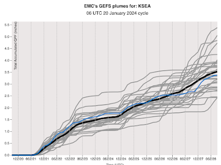
The UW model's cumulative precipitation forecast for the next ten days will bring a smile to local ducks and slugs, with substantial precipitation (reaching totals of 10 inches in the mountains), from central California to British Columbia.


I thoroughly enjoy and get a chuckle over how you "instruct" your media friends regarding their fictional narrative: drought and climate change fear mongering. Facts as you present and teach are like breezes of brisk fresh air among the media's largely unfounded narrative of doom it collectively employs in order to obtain website "clicks."
ReplyDeleteIt has not felt like a normal winter instead of the ususal many cold drizzly days we have had a few warm heavy rain events. We have had near record warmth and near record cold but not alot of average days and the snowpack is signifigantly less than what you'd expect given how much precipitation we have had although its alot better than it was. The lack of snow is most pronounced it the Olympics and Mt Baker.
ReplyDeleteI was going to mention that the upcoming precipitation is associated with very high snow levels. If you check mountain-forecast, you'll see that the predicted freezing level is higher than than even Mt Olympus by end of next week. That's a ways off, so may not verify, but it does accord with Cliff's temperature figures in this post. Not very helpful for snowpack.
Deletehttps://www.mountain-forecast.com/peaks/Mount-Olympus-2/forecasts/2427
The snowpack in Oregon was at 28% of normal at the end of December. After the numerous snow and ice events over the past two weeks, it now stands at 82%, with additional amounts coming the next two weeks. The story is never over and rarely definitive, no matter the MSM narratives.
DeleteAs someone who lives in Cle Elum this is most welcome news! The biggest issue over the past week has been the numerous power outages causes by electrical line failures due to downed trees and power generation issues in addition to I90 road conditions. It seems that WSDOT didn't use any de-icing products on the road or left it too late and a slab of thick ice remains bonded to the roadway until it warms this week resulting in several accidents including a jackknifed semi. A friend from PSE informed me that Lake Cle Elum residents were without power due to not enough electricity to feed the grid. Interestingly WA state Governor Jay Inslee is pushing forward with new EV subsidies & targets despite an electrical grid that is incapable of meeting current demand. Looking forward to the warm up!
ReplyDeleteInside the BPA's area of load balancing authority, while wind power has been barely present the last seven days at 1/10th or less of its total nameplate of 2,800 Mw, the Columbia Generating Station has been chugging along continuously at its full nameplate capacity of 1,100 Mw.
DeleteHere in the US Northwest as a whole, roughly fourteen billion dollars has been spent over the last twenty-five years installing a total of roughly 6,000 Mw of nameplate wind. What did we actually get for that all that money? What could we have gotten had that money been spent instead on completing the WPPSS Satsop plant?
Current drought monitor has North
ReplyDeleteCascades in moderate to serve drought, any signs of improvement before our long hot summer begins?.
Often get a lot of snow in the mountains in February April and May. The drought monitor has been discussed by cliff many times with regards to its' inaccuracy.
DeleteWashington snowpack is still below average as of January 21, per Snotel. Not a cause for alarm, but maybe a bit early to break out the champagne? Near-normal precipitation combined with above-average precipitation will translate to below-average snow accumulation over the near term at least.
ReplyDeletehttps://www.wcc.nrcs.usda.gov/ftpref/data/water/wcs/gis/maps/wa_swepctnormal_update.pdf
I suspect that the elevated duck activity will wipe the smiles off the faces of more than a few of those slugs.
ReplyDeleteWhile the precipitation total for the Tri Cities area and other low elevation stations in the Columbia Basin since October 1st may be normal or a bit above, it is not so much the case in the more mountainous areas of the Cascade east slopes and northern mountains. Here is the percent of normal from October thru December 2023 of a few stations in these areas: Colville 87%. Northport 93%. Mazama 86%. Winthrop 82%. Stehekin 84%. Plain 75%.
ReplyDeleteEaston 80%. Ellensburg 71%. The snow water equivalent in all the mountain areas is currently also below normal, mostly 70 to 80% of normal. This often seems the case in El Nino years where the low elevation Basin stations get near or above normal precip. while the mountain areas end up below normal, possibly due to the more frequent southerly type airflow during El Nino years that nullify the rain shadow effect of the Cascades. If the outlook for another warm, dry summer for 2024 verifies, we could see water issues later on.
My grapefruit tree will be much relieved.
ReplyDelete