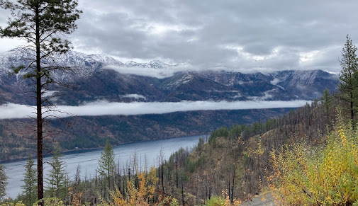
Yesterday I received a dramatic photograph from Steve Tongue, the Operations Manager of Holden Village, that shows a narrow cloud that extended along the central axis of Lake Chelan (see below).
Mr. Tongue has a fun, descriptive name for this feature: a "Boa Cloud", due to its snake-like appearance.
This picture was taken yesterday (Wednesday) around 11 AM and Mr. Tongue suggests that such snake clouds occur fairly regularly.
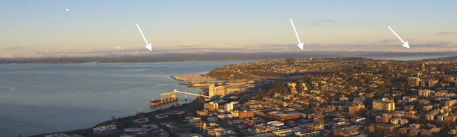
When I saw this cloud, positioned along the center of a body of water, I noted its similarity with a similar feature in western Washington--the line of clouds the sometimes form down the center of Puget Sound and Lake Washington during cool periods when the air temperature is below the water temperature.
Here is an example for February 18, 2020. You can see the snake (indicated by the white arrows).
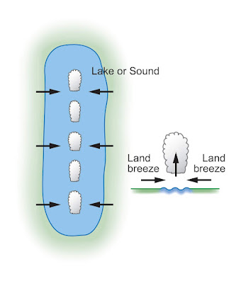
In western Washington, these narrow cloud features in the middle of long water bodies are virtually always associated with cold air over land and relatively warm water, with at least a 10F difference, and often more. Such situations can set up land breezes along the shore that converge over the center of the water body. Converging air forces upward motion in the middle of the water body, with the resulting upward motion resulting in clouds.
An illustration from my Northwest weather books shows the situation. Land breezes from land to water are driven by the differences in temperature (water warm, land cool), and represent the opposite of sea breezes, where air moves towards land when it is warmer than the water.
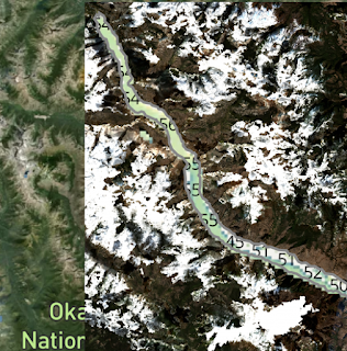
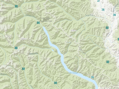
But what about temperatures over land? The low temperatures were quite cool yesterday morning around Lake Chelan, dropping into the lower to mid-30s F (see below) So we are talking about a roughly 20F difference between the land and water temperatures--more than enough to produce a land breeze on both sides of Lake Chelan that converged to produce the "Boa Cloud."
Finally, one of the most spectacular aurora displays in a while occurred over our region last night, but unfortunately, clouds obscured it for most. But there was a brief gap in the clouds around 4-5 AM and Greg Johnson of Skunk Bay Weather captured some of the excitement:

Just spectacular. The video is below:
.png)


Hi Cliff, thanks for posting the picture of the aurora. The link to the video doesn't work for me... could you please check it and correct if necessary? Thank you !!
ReplyDeleteVideo worked on my iPhone… Great - fun - blog!
ReplyDeleteWoke up early yesterday to see the Aurora Borealis from Point No Point, not far from where Skunk Bay is. Just spectacular!
ReplyDelete