More snow is coming tonight for the lowlands of Northwest Washington and the Columbia Basin.
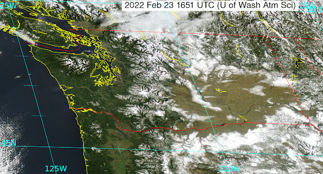
But before I get into that, check out this morning's visible satellite image showing a nearly cloud-free Washington State and northern Oregon. Just spectacular.
You can see the snow over the mountains as well as regions of non-mountain snow over the eastern Washington and Oregon lowlands.
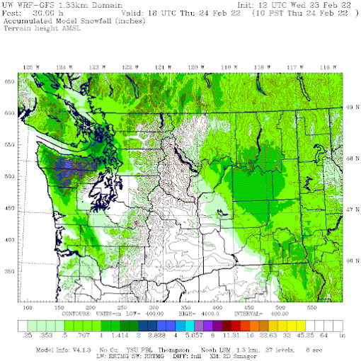
A weak upper-level disturbance, embedded in northwesterly flow aloft, will move through tonight and tomorrow morning. The result will be light snow. Below is the forecast by the UW high-resolution model of snowfall through 10 AM tomorrow. Up to about an inch over Northwest Washington and the Columbia Basin, with even more on the northwest side of the Olympics, forced by northwesterly (from the northwest) airflow moving up the terrain.
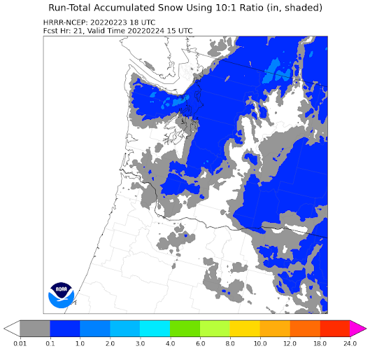
I should note that the latest National Weather Service high-resolution model (HRRR) forecast for the same period is similar (see below), but pushes the light snow into north Seattle.
I should note, that such detailed forecasts were not possible twenty years ago. We have come a long way!
Finally, a major snowfall looks likely in the Cascades and mountains of BC on Sunday into Tuesday. More later.


Really enjoy reading your forecasts, thanks.
ReplyDelete11 PM currently getting a proper dusting of snow in Mt Vernon. Even a little foothills elevation 50-100 feet seems to make a noticeable difference where it sticks.
ReplyDeleteQuite an unusual winter: record lows at the beginning and end of winter, and fairly mild the rest of the time. On Monday, when it lightly snowed, at one point the sun was shining in my neighbor's yard across the street and it was snowing in my yard. My own private convergence zone - ha. Gotta love Washington.
ReplyDeleteAs for me, I don't call what we had a week or two ago a false spring. I call what we're having now a false winter. Having said that, I do believe in climate change, because I think it's important for all of us to do our part to keep our planet the majestic beauty she is.
Mr. Mass: Here in Spokane, a recent tv-news report by Chris Farley, KING-5, suggests that snowpack in Washington State will be all but extinct in just about 20 years, which is virtually tomorrow, in relative terms. That would certainly mean that in 10 years, it will be *almost* extinct. Hype or reality?
ReplyDeletesimply not true....
DeleteSome glaciers were supposed to have completely melted by now according to the same experts. Cliff sure has a lot of patience with folks like you constantly posting misinformation.
DeleteKerry was just asking... didn't say he necessarily believed it.
Delete"folks like you"?
DeleteAre you trying to tell me that people on the internet are not allowed to question experts about misinformation being transmitted by the mainstream-media?
Perhaps your reading comprehension is not adequate for complex topics?
OK, Enough! Let's have spring. This is stalling my spring bulbs...
ReplyDelete