My new podcast is out (see details below), and I cover two important topics: the radical change in our weather that will occur this weekend, and the substantial variations in local temperatures on cold nights.
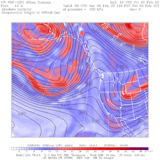
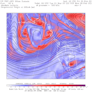
Take a look at the upper-level (500 hPa, about 18,000 ft ASL) flow this morning and on Monday night. This morning, the ridge is right on the coast--a situation associated with sinking air and sunny skies.
But on Monday evening, the ridge has moved inland and the Northwest is in strong southwesterly flow off the Pacific. A large trough is offshore. This is a warm/wet pattern.
Total precipitation through 4 PM Monday is impressive (see below), with locations in the mountains getting more than 5 inches!
My podcast gives more details on the forecast. And my podcast also describes and explains the large local variations of low temperatures on cold mornings, such as on Wednesday.
It all makes sense if you know what is going on, and you will after you listen to the podcast.To listen to my podcast, use the link below or access it through your favorite podcast service.
Some major podcast servers:
Like the podcast? Support on Patreon


I have had some tender plants wrapped up all winter, and now that the crocus are blooming, I would like to pull that stuff off. What are the historical odds that we will get temperatures in the teens in March? I saw your chart of record lows, so I know there is some risk.
ReplyDeleteThanks in advance!
If the high pressure remains up north that could bring enough cold air to do it. I would keep your plants in till late March but even then this pattern screams late freeze too me. We have had some stupid record lows historically all the way up to late May and this pattern is ripe for cold dry due to no 4 corners high to our SE.
DeleteI looked for the last frost dates for the Seattle/Tacoma area and found it in Dave's Garden online and for 50% chance of temps reaching 32* is March 10th, with a 10% of temps getting that cold on April 4th.
ReplyDeleteAt this point, we are still at above 50% for temps to reach down to freezing, or perhaps below so too early to unwrap delicate plants. I will look at the seed packet for the Brandiwine tomatoes I plan on planting and see how many days prior to then that I should start the seeds. Now, I will likely wait until the soil temps in early morning are at or near 50*, which puts me into May before I transfer them outside.
Did this with some heirloom tomatoes last year, and almost lost them when I began to acclimate them to the outdoors as early May was still cool and a bit blustery, but had 3 that survived and thrived and gave me plenty of tomatoes, only to pull them when the weather in Sept began to turn south.
Cliff, would it be possible to post transcripts of your podcasts along with the recordings? I find it easier to skim a transcript when I'm busy than to sit thru the audio -- it's easy to miss important points when my attention is divided. (Multitasking is a myth 😀)
ReplyDeleteLooks like cooler and drier weather returns by next weekend. A short lived warm and wet period in between persistent ridging.
ReplyDeleteIf anyone has noticed there is NOT a sign of a 4 corners high pattern which is what usually turns on the fire alarm to full alert for our region. I'm hoping if we are stuck dry this pattern keeps going which will give us the potential for some pretty late season lows similar to old skool Oregon.
ReplyDeleteKSLE has some amazing record lows for the summer time pre airport era when the weather station used to exist I think downtown.