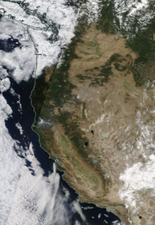
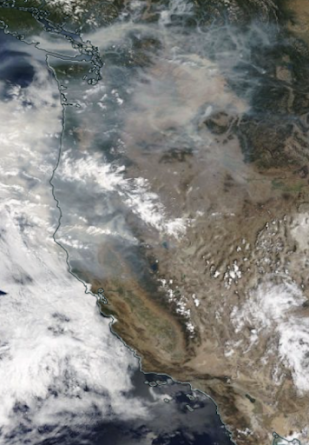
This has been a particularly smoke-free summer so far over the entire West Coast, and to appreciate our clean-air bounty, let's compare satellite imagery between this afternoon and a year ago.
Yesterday's MODIS visible satellite image shows smoke-free skies over nearly the entire western U.S., with two exceptions: a very small fire west of Lake Chelan and a modest smoke area in northern CA. That is about it!
Compare that to the smoky miasma of exactly one year ago. Yuck! Smoke everywhere!
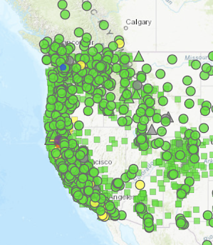
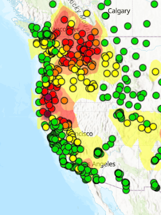
The air quality data provided by the EPA in their AIR NOW network shows the story on the ground. This year, nearly all sensors indicate good (green) air quality. You can breathe freely in virtually the entire West.
But last year on the same date lots of yellow and reds (poor air quality), particularly over eastern Washington and northern California.
Finally, looking forward in time, here is the NOAA HRRR model smoke forecast for today at 5 PM. This shows the total smoke in a vertical column..the amount at the surface would be much less.
Not too bad for this time of the year!
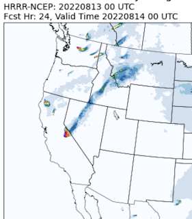


Norcal/Sierra has had a fair amount of moisture with their t-storms recently, as near record Pwats have been observed during the last few monsoonal surges. This has likely contributed to less fire starts than would normally be the case with drier storms.
ReplyDeleteHopefully our media, politicians and the general public will slowly begin to understand the complexities of our natural world.. including forest fires.. Our world, and especially the natural world is far from black and white... complexities, within ourselves and the world itself is one of the many reasons why I thoroughly enjoy the constant change that we all live in.. Thanks Cliff
ReplyDeleteWhile we did have a wetter spring and a more moist, cool early part of the summer, the heat and dryness of mid to late summer has pretty much eliminated the effects of this earlier period and most areas of Eastern Washington are now primed for fire. We have been fortunate this summer, as in some past summers, to have had a lack of dry lightning storms, which are the main cause of our larger forest fires. Lightning that is accompanied by a fair amount of rain or high humidity usually does not create an immediate fire problem, but may lead to sleeper fires popping up several days later if weather turns warm and dry,. The current lightning-caused White River fire, burning west of Lake Wenatchee, is an indicator of how dry the forest is now as this area is in a cooler, more moist area that is lesser prone to fire than the drier forests farther to the east. We are usually not out of the woods with regards to lightning fires until September. One of the worst fire producing dry lightning storms in the Wenatchee/Okanogan occurred on August 24,1970 and burned over 100,000 acres..
ReplyDelete